Among latest activities of RSO there are several recommended practices on the exploitation of satellite imagery for disaster risk management and emergency response. These practices were discussed at the 5th UN-SPIDER RSO-Meeting 13 and 14 February 2014 in Vienna, Austria, and were disseminated through the UN-SPIDER Knowledge Portal.

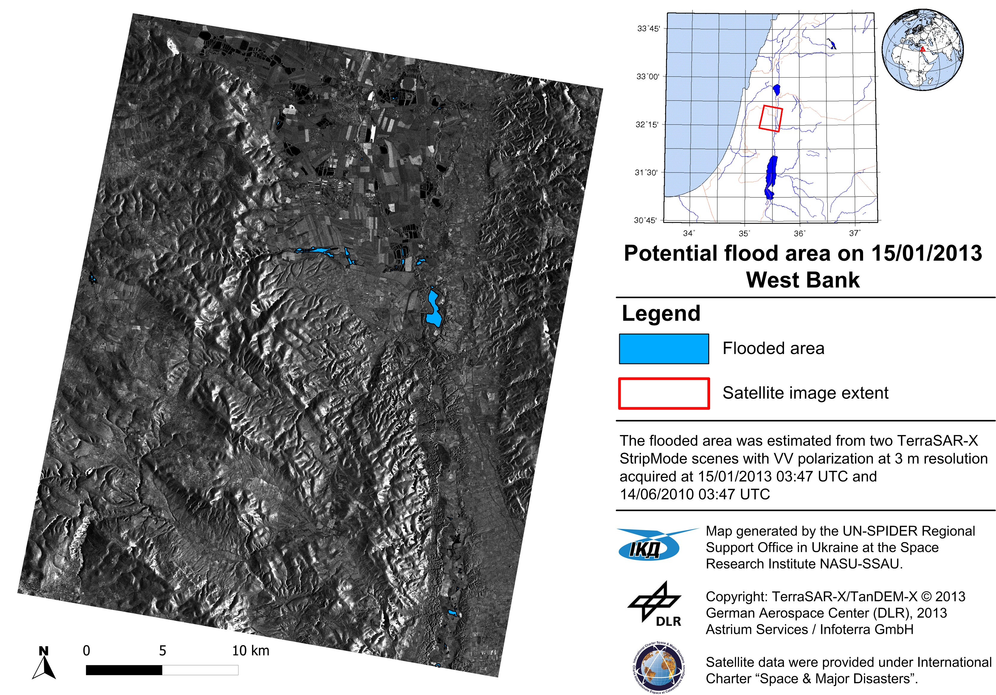
The first practice is devoted to the use of SAR satellite imagery for flood mapping. The practice shows the use of ESA NEST software for pre-processing and processing of SAR imagery using a threshold method for deriving flood extent. The QuantumGIS software is used to visualize the results of image processing.
| Document title | Link |
| SAR flood mapping, description | download |
| SAR flood mapping, workflow | download |
| SAR flood mapping, NEST manual |
download |
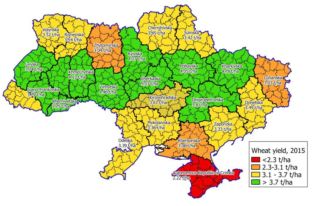
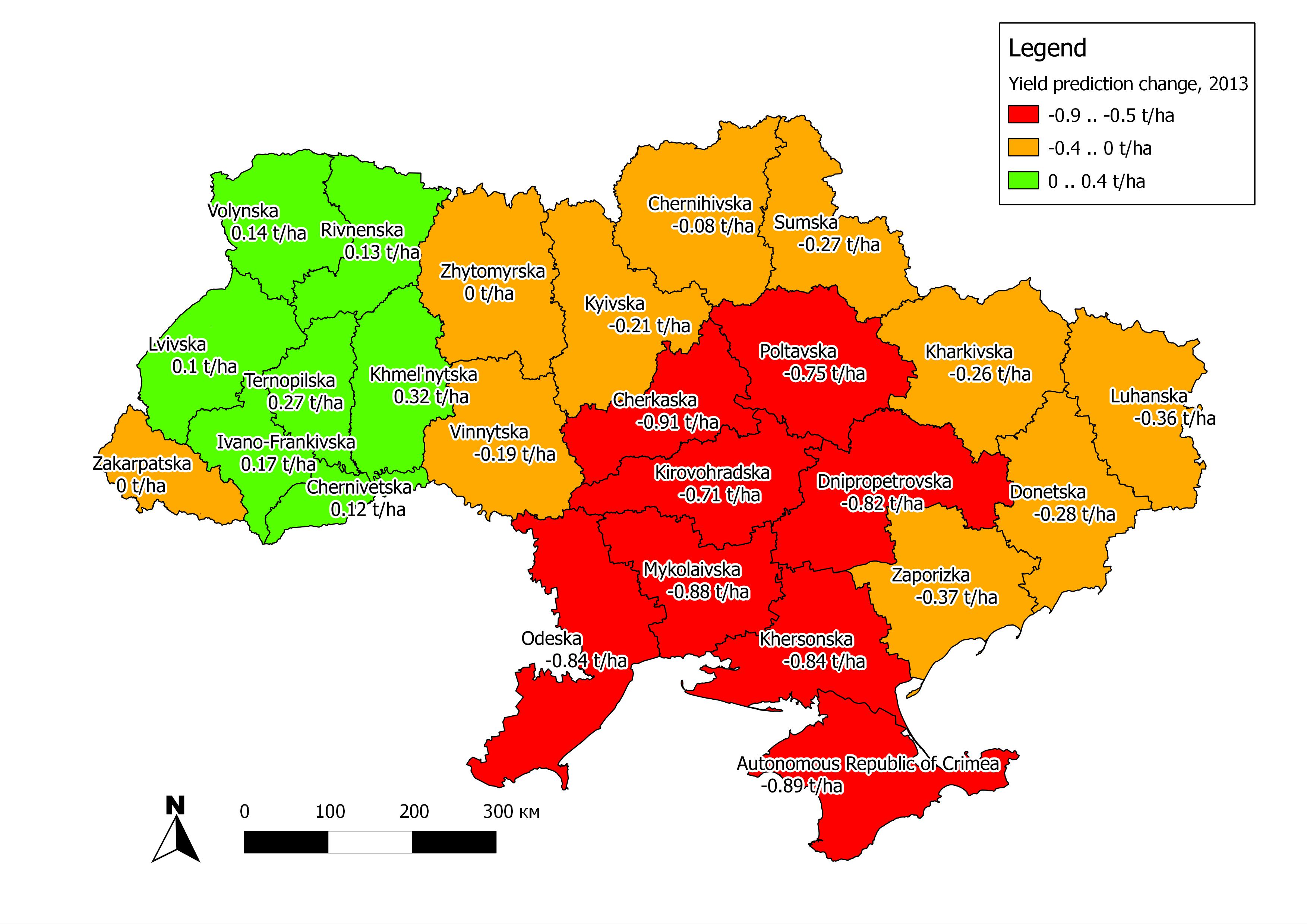
The second practice is focused on using NDVI values derived from MODIS to build a linear regression model for crop yield forecasting. It is shown how QuantumGIS software can be used to extract average NDVI values over administrative regions. This data is further integrated with official statistics on crop yield to build a regression model. For this purpose, any statistical package can be used.
| Document title | Link |
| Crop yield prediction, description | download |
| Crop yield prediction, workflow | download |
Video with workflow description (second practice)