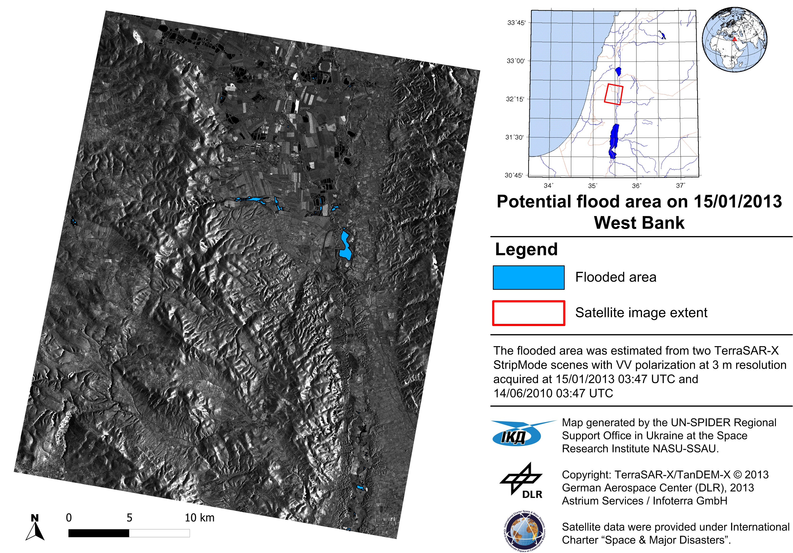
Experts from UN-SPIDER RSO in Ukraine developed new methodologies to flood hazard mapping from satellite data. The first approach envisages statistical processing of time-series of Landsat-5 and Landsat-7 images to derive a probability of inundation map over the region of interest.


The second approach is targeted for event-specific flood hazard mapping. It utilizes neural networks to produce a posteriori probability of the area being inundated.
The use of satellite imagery to multi-event and event-specific flood hazard mapping (pdf.)