Scientific publications:
- S. Skakun, N. Kussul, A. Shelestov, O. Kussul. Flood Hazard and Flood Risk Assessment Using a Time Series of Satellite Images: A Case Study in Namibia // Risk Analysis. – 2014. – Vol. 34, No. 8. – doi: 10.1111/risa.12156. – P. 1521 – 1537;
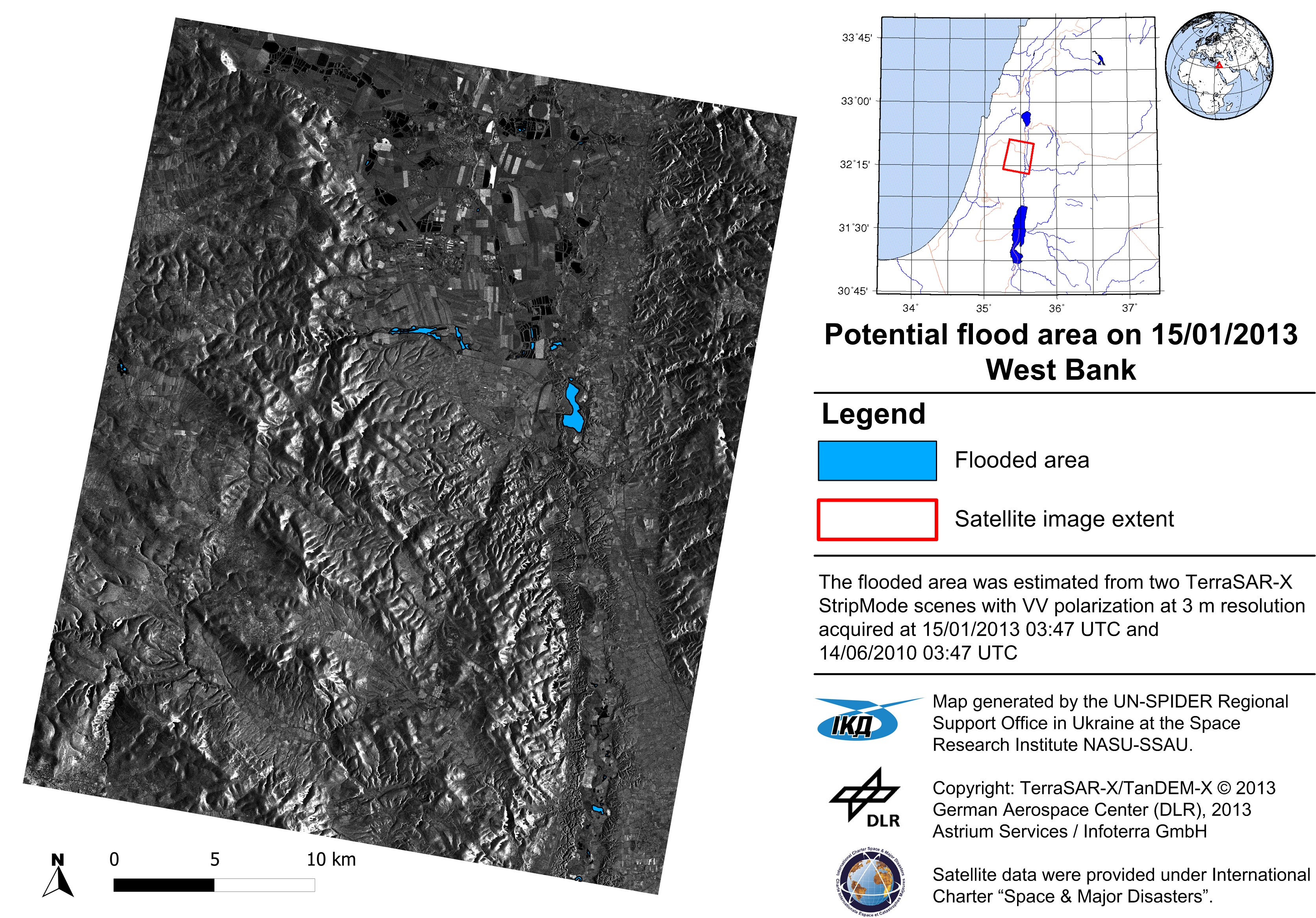
- N. Kussul, A. Shelestov, S. Skakun, G. Li, O. Kussul, J. Xie. Service-oriented infrastructure for flood mapping using optical and SAR satellite data // International Journal of Digital Earth . – 2014. – Vol. 7, No. 10 – P. 829 – 845;
- J. Gallego, N. Kussul, S. Skakun, O. Kravchenko, A. Shelestov, O. Kussul. Efficiency assessment of using satellite data for crop area estimation in Ukraine // International Journal of Applied Earth Observation and Geoinformation. – 2014. – No. 29. – P. 22 – 30.
- N. Kussul, S. Skakun, A. Shelestov, O. Kussul and B. Yailymov. Resilience Aspects in the Sensor Web Infrastructure for Natural Disaster Monitoring and Risk Assessment Based on Earth Observation Data // IEEE Journal of Selected Topics in Applied Earth Observations and Remote Sensing. – 2014. – Vol. 7, No. 9 – P. 3826 – 38