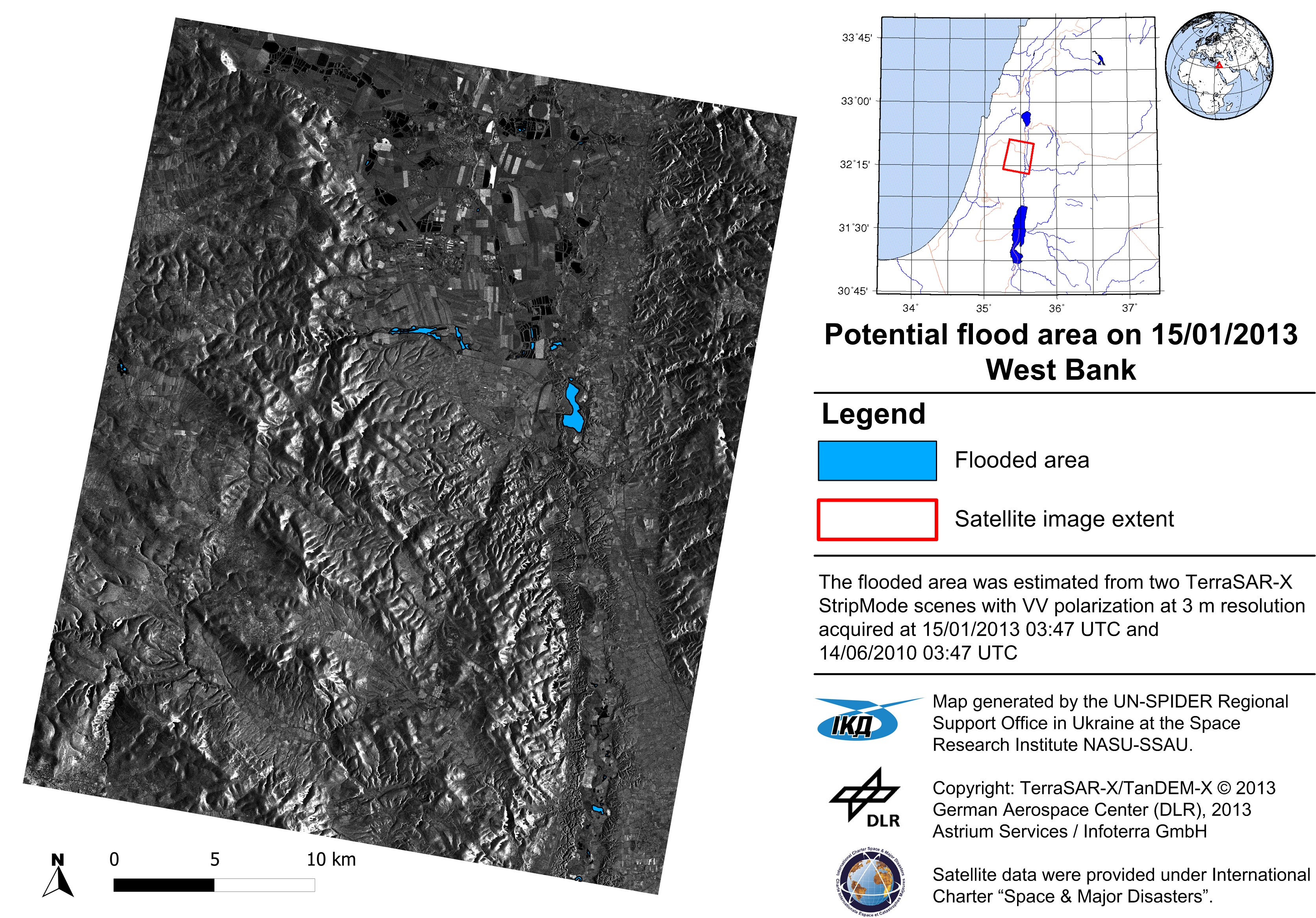
- International Charter Call for West Bank, January 2013
- The operation flood mapping from TerraSAR-X satellite (Two scenes acquired on 15 January 2013)
- Flood risk assessment:
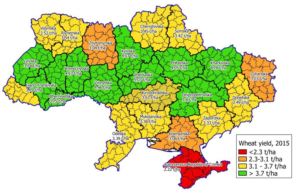
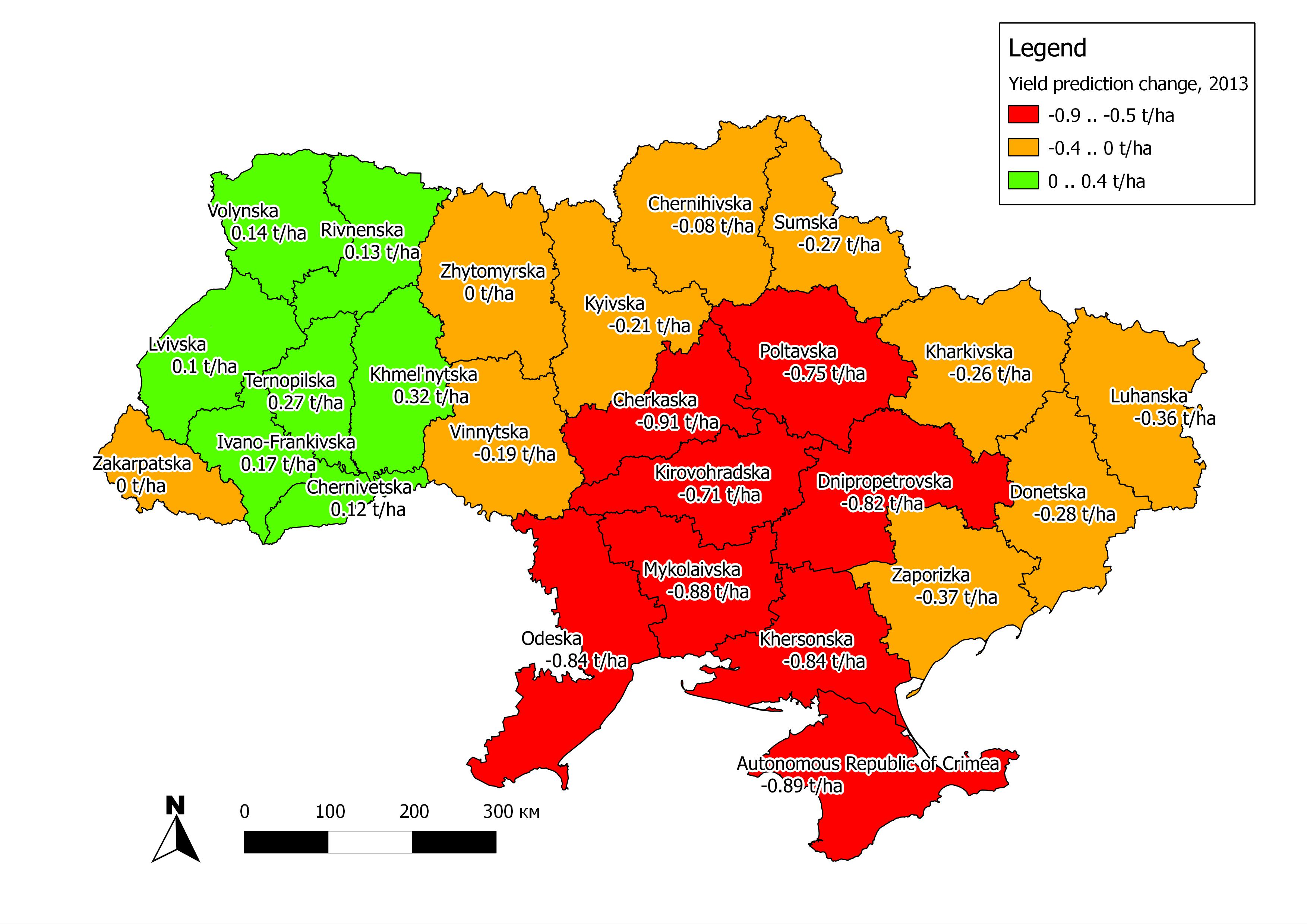
- Operational forecasting of winter wheat yield in Ukraine for 2013 based on Earth observation, results delivered to the Department of Agriculture of Ukrainian Hydrometeorological Center
- Quantitative flood risk mapping for Namibia based on time-series of satellite imagery (Landsat-5/TM and Landsat-7/ETM+ – 102 scenes, 1989-2012)
- EO-1 satellite images feature ice cover on the Dnieper river
- Image acquisition date is 29 March 2013
- Image was taken at 07:59UTC, and was made available at about 11:25UTC
- Products delivered to the State Space Agency of Ukraine and State Emergency Service