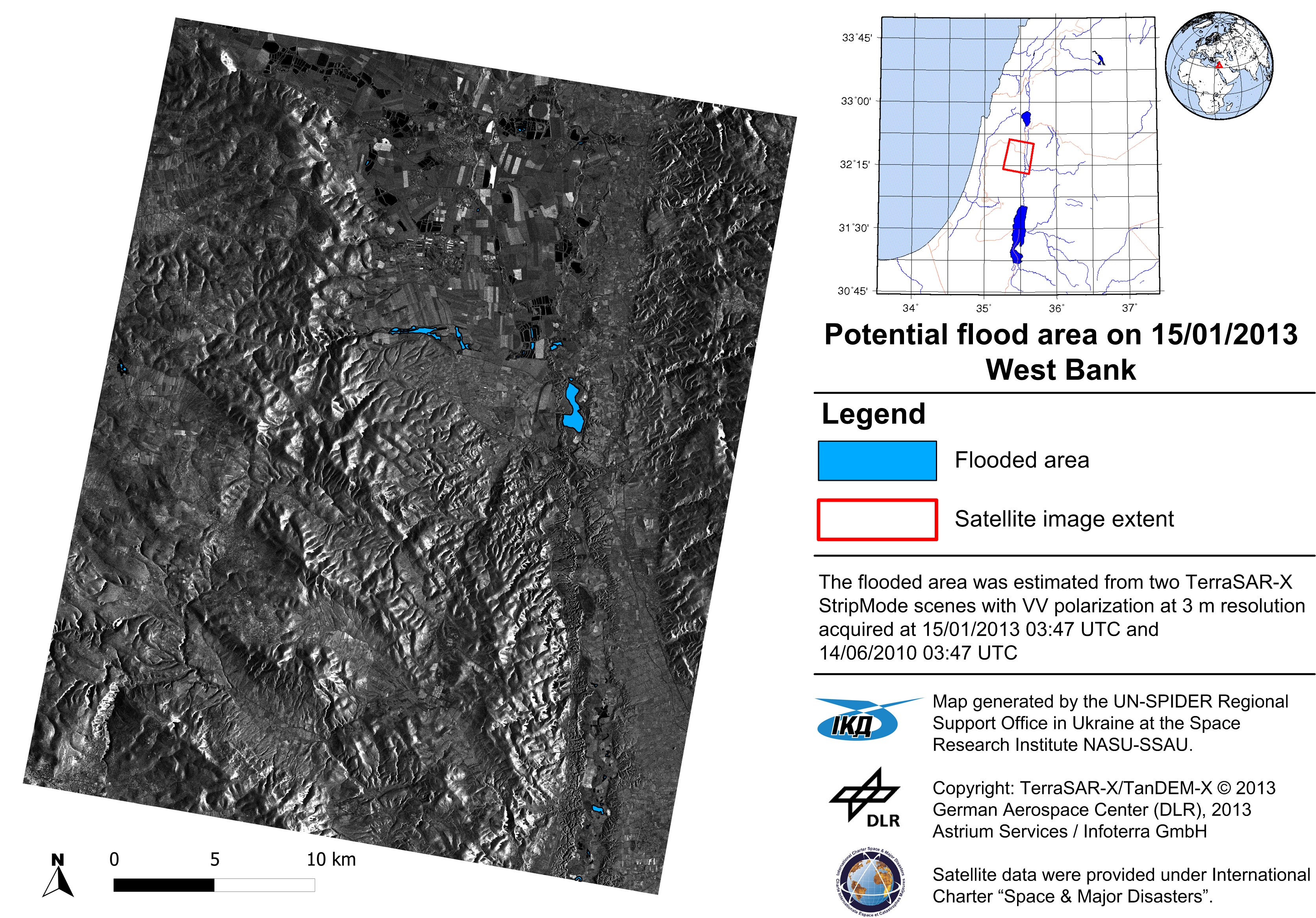
- Flood risk assessment – Sich-2 and EO-1 satellite images feature ice cover on the Dnieper river with the hole made to keep ice away from the hydroelectric power station and dam (17 March 2012)
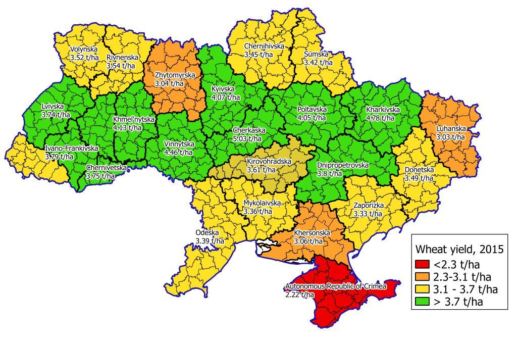
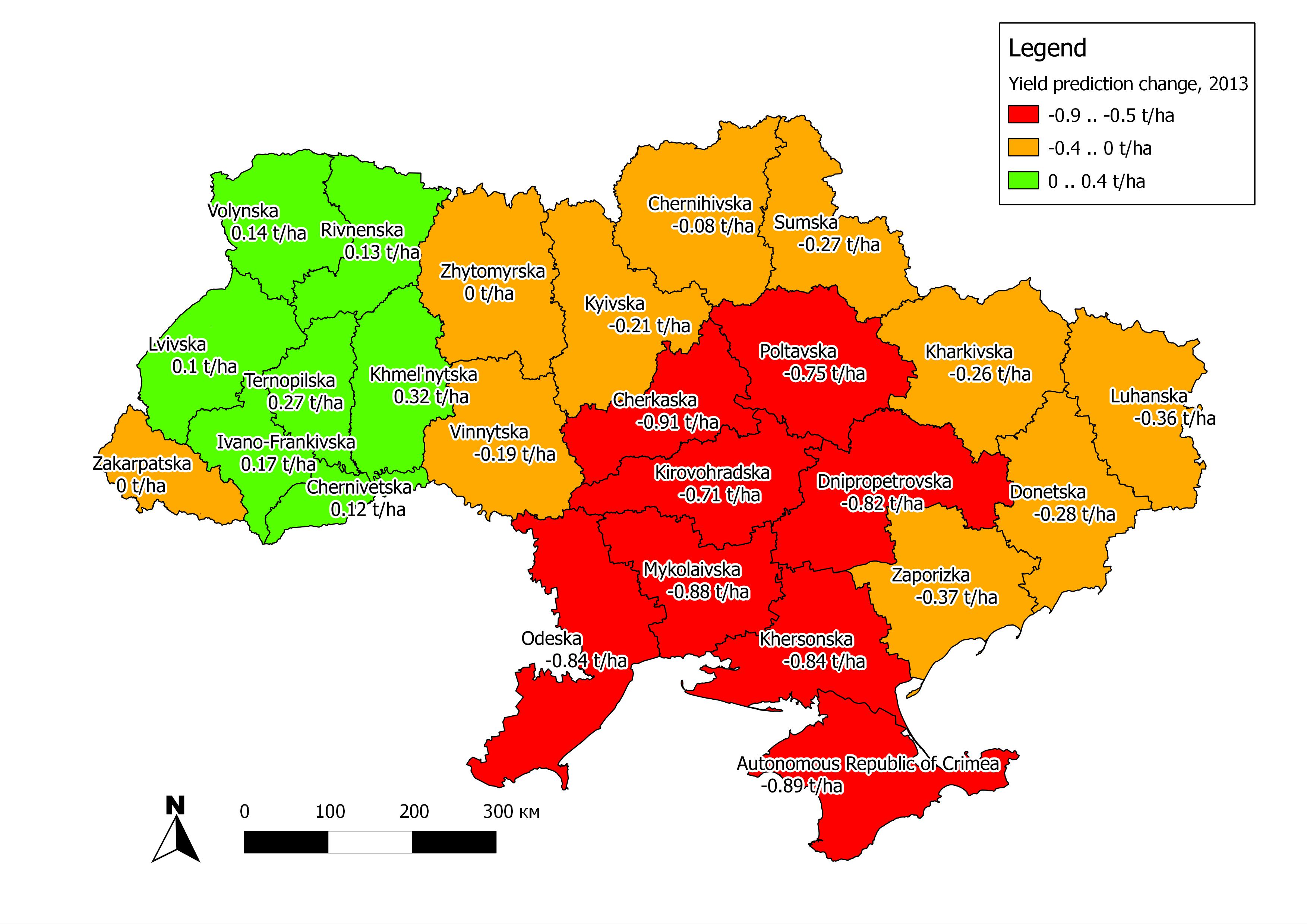
- Operational forecasting of winter wheat yield in Ukraine for 2012 based on Earth observation, results delivered to the Department of Agriculture of Ukrainian Hydrometeorological Center,
published in article: Kogan, F., N. Kussul, et al. “Winter wheat yield forecasting in Ukraine based on Earth observation, meteorological data and biophysical models” International Journal of Applied Earth Observation and Geoinformation, 2013 - International Charter Call for Cameroon, September 2012 – operation flood mapping from Sich-2 satellite (10 September 2012 over city of Maga, 15 September 2012 over city of Garoua)
- Main
- Events
- Activities
- Training
- Recommended practices
- User request form
- Publications
- Workplan and report